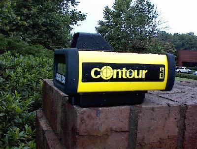
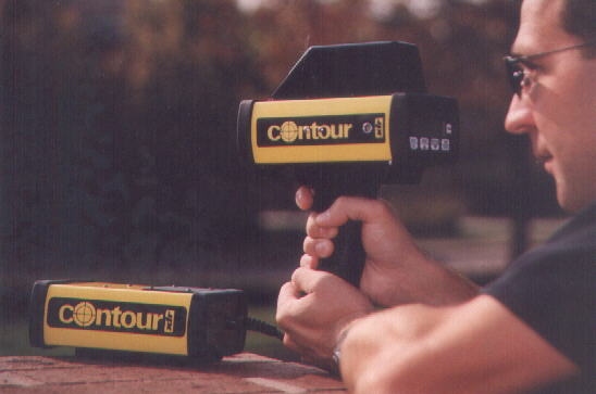
LaserCraftژذƒŒپ[ƒUپ[‹——£Œv ContourƒVƒٹپ[ƒY

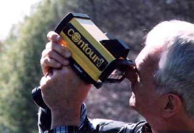
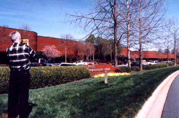
 ContourƒVƒٹپ[ƒY‚حƒNƒ‰ƒX1ƒŒپ[ƒUپ[ژg—p‚جƒnƒ“ƒfƒBƒ^ƒCƒv‚جƒŒپ[ƒUپ[‹——£Œv‚إ‚·پB
RS232C‚ة‚و‚èگ§Œن‰آ”\‚إ‚·پB
Œv‘ھگ«”\
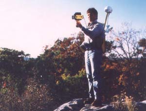
1. 175mگو‚ج“ھڈم‚جƒPپ[ƒuƒ‹پi‘—“dگüŒv‘ھƒ‚پ[ƒh‚ ‚è‚ـ‚·پBپj
2. 400mگو‚ج“d’Œ
3. 400mگو‚جژ÷–طپi—t‚ب‚µپj
4. 800mگو‚جŒڑ•¨–”‚حژ÷–طپi—t‚ ‚èپj
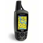
‹——£Œv‘ھ‚ج‚فپFCoutour XLRپAContour XLRMپiƒ‚ƒWƒ…پ[ƒ‹ƒ^ƒCƒvپj
‹——£پE‰”’¼ٹpپAچ‚‚³پFContour XLRiپAContour XLRM iپiƒ‚ƒWƒ…پ[ƒ‹ƒ^ƒCƒvپj
‹——£پE‰”’¼ٹpپAچ‚‚³پAگ…•½ٹpپAگ…•½‹——£پFContour XLRicپAContourXLRM icپiƒ‚ƒWƒ…پ[ƒ‹ƒ^ƒCƒvپj
’·‹——£Œv‘ھپFContour MAX
•¾ژذ‚©‚炲چw“ü‚ج‚¨‹q—l‚ة‚حExcel‚إƒfپ[ƒ^ژûڈW‚âƒRƒ}ƒ“ƒh‚ً‘—گM‚إ‚«‚é‰ü‘¢ژ©—R‚جExcel‚إٹب’Pƒfپ[ƒ^ژûڈW‚إ‚«‚éƒ\ƒtƒgSILogger‚ً–³ڈ‚ة‚ؤ‚²ژg—p‚¢‚½‚¾‚¯‚ـ‚·پBڈع‚µ‚‚ح‚±‚؟‚ç‚ض
 |
 |
 |
 |
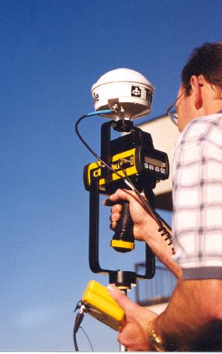  |
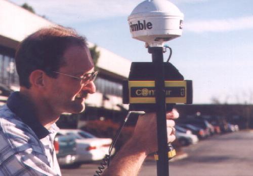
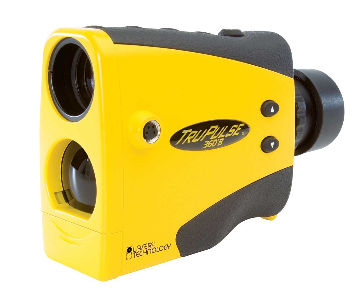
ƒ‚ƒWƒ…پ[ƒ‹ƒ^ƒCƒvCONTOUR MƒVƒٹپ[ƒY
ٹO•”“dŒ¹—pƒVƒKƒ‰ƒCƒ^پ[ƒvƒ‰ƒO•t
|
pdfƒpƒ“ƒtƒŒƒbƒg‚ح‚±‚؟‚ç‚©‚çƒpƒXƒڈپ[ƒh‚ً“üژ肵‚ؤƒ_ƒEƒ“ƒچپ[ƒh‚إ‚«‚ـ‚·پBپi–³—؟پj
Œ©گد‚è‚ج‚²ˆث—ٹ‚ح‚±‚؟‚ç‚ضپ@‚²’چ•¶•û–@پiŒآگlپA–@گlپAŒِ”ïچw“üپjپE‘——؟پE‘مˆّژèگ”—؟‚ة‚آ‚¢‚ؤ
(’تگM”ج”„‚ج–@‹Kپi–K–â”ج”„–@پj‚ةٹî‚أ‚•\ژ¦‚ًŒن——‰؛‚³‚¢)
پ@![]()
XLRMƒ^ƒCƒv‚حƒ‚ƒWƒ…پ[ƒ‹ƒ^ƒCƒv‚إ‚·پB
ٹeژذƒŒپ[ƒUپ[‹——£Œvژd—l”نٹr‚ح‚±‚؟‚ç‚إ‚·پB
گ³‹K”ج”„“X‚ئ‚µ‚ؤ”ج”„ƒLƒƒƒ“ƒyپ[ƒ“’†‚إ‚·پB
|
Coutour XLR |
Contour XLRi |
Contour XLRic |
Contour MAX |
|
|
ژQچl‰؟ٹi |
ژQچl‰؟ٹiپڈ |
ژQچl‰؟ٹiپڈ |
ژQچl‰؟ٹiپڈ |
ژQچl‰؟ٹiپڈ |
|
‘ھ’è‹——£ |
175mگو‚ج“ھڈم‚جƒPپ[ƒuƒ‹ |
3kmگو‚ج”’•اŒڑ•¨ |
||
|
•ھ‰ً”\
|
0.1m
|
1m
|
||
|
گ¸“x |
0.15 meter to a white target at 85 m |
+/-1m at 1.5km |
||
|
Œv‘ھژٹش
|
0.33•b
|
|||
|
گ‚’¼ٹp“x |
•s‰آ |
360پ‹
|
+/-40پ‹
|
ƒIƒvƒVƒ‡ƒ“ |
|
“¯ڈمگ¸“x |
•s‰آ |
+/-0.1پ‹
|
+/-0.1پ‹
|
ƒIƒvƒVƒ‡ƒ“
|
|
•ûˆت |
•s‰آ
|
0پ`360پ‹ |
ƒIƒvƒVƒ‡ƒ“
|
|
|
“¯ڈمگ¸“x |
•s‰آ
|
+/-0.5پ‹ |
ƒIƒvƒVƒ‡ƒ“
|
|
|
ƒŒپ[ƒUپ[ƒNƒ‰ƒX |
ƒNƒ‰ƒX1 |
|||
|
“dŒ¹ |
ƒjƒbƒPƒ‹گ…‘f“d’rپi24ژٹشژg—pپj |
|||
|
ٹO•”“dŒ¹
پiƒIƒvƒVƒ‡ƒ“پj |
ژش‚جƒVƒKƒŒƒbƒgƒvƒ‰ƒO(DC9-18V)
|
|||
|
ƒCƒ“ƒ^پ[ƒtƒFƒCƒX |
RS232C |
RS232C |
||
|
“®چى‰·“x
|
-30پژپ`60پژ
|
|||
|
گ،–@cm |
18.8 x 10.8 x 25.4پ@ |
18.8 x 10.8 x 26.9
|
18.8 x 10.8 x 25.4 |
|
|
ڈd—ت |
1.36kg |
1.6kg |
1.59kg |
|
•t‘®•i‹y‚رƒIƒvƒVƒ‡ƒ“
•t‘®•i ƒoƒbƒeƒٹپ[پAڈ[“dٹيپAƒ\ƒtƒgƒoƒbƒO 1پDƒ‚ƒmƒ|پ[ƒ‹ ژQچl‰؟ٹi پڈ21,000- 2پDƒˆپ[ƒNپi5/8ƒCƒ“ƒ`‘ھ—تژO‹rژو•tƒAƒ_ƒvƒ^پj ژQچl‰؟ٹi پڈ33,600- 3پDRS232CƒPپ[ƒuƒ‹ ژQچl‰؟ٹi پڈ15,750- 4پDƒtƒBƒ‹ƒ^پ[پi”½ژث”آ‚ج‚ف‚ًŒv‘ھ‚·‚éڈêچ‡پj ژQچl‰؟ٹi پڈ26,250- 5پDƒgƒٹƒ“ƒuƒ‹TSC1—pƒPپ[ƒuƒ‹ ژQچl‰؟ٹi پڈ18,900- 6پD‰^”ہ—pƒnپ[ƒhƒPپ[ƒX ژQچl‰؟ٹi پڈ30,450- 7پDƒVƒKƒŒƒbƒgƒ‰ƒCƒ^پ[ƒvƒ‰ƒO ژQچl‰؟ٹi پڈ19,950-
CONTOUR XLR ic‚ج‹@”\—ل
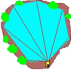
2“_ٹش‚جژخ‹——£پAگ…•½‹——£
–تگدŒvژZ
ƒfپ[ƒ^ژûڈWپEٹد‘ھپEŒvژZƒ\ƒtƒg
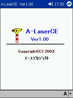
A-LaserCE
20,000‰~پ`
“®چىٹآ‹«پF“ْ–{Œê”إWindowsCE 3.0ˆبڈمپiPocketPC‚©پAPocketPC2002پAPocketPC2003پAMobile5.0پj
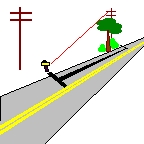
چ‚‚³Œv‘ھپi2“_ٹشŒv‘ھپA3“_ٹشŒv‘ھپj
ƒPپ[ƒuƒ‹‚جگ…•½‹——£‚âچ‚‚³
ƒCƒ“ƒ^پ[ƒtƒFپ[ƒXژd—lپiRS232Cپj
|
GPS‚إٹيٹB“_ژو“¾
|
ƒŒپ[ƒUپ[‹——£Œv‚إ‹پ“_‚ًژو“¾
|
||||||
 LaserTechnologyژذTrupulse360 KustomsignalژذContor  MPHژذAdvantage |
 VectronixژذVector 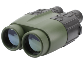 NewconOptikژذ6000CI |
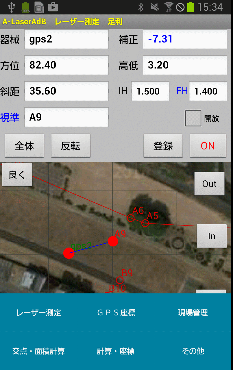 A-LaserAd ƒfپ[ƒ^•غ‘¶Œ`ژ® |
 GoogleEarth 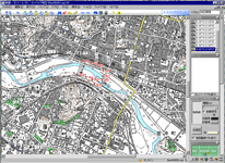 ƒJƒVƒ~پ[ƒ‹3D ‚»‚ج‘¼CADƒ\ƒtƒgپAGISƒ\ƒtƒg‚ضƒfپ[ƒ^‚ًƒCƒ“ƒ|پ[ƒg‚إ‚«‚ـ‚·پB | ||||
پ@ —p“r
”ُچl
1پD Œڑ’z ٹTژZŒ©گد—p‚جٹبˆصŒv‘ھ‚ةپAˆہ‘S‹——£Œv‘ھ‚ة 2پD “y–ط ٹTژZŒ©گد—p‚جٹبˆصŒv‘ھ‚ة 3پD •s“®ژY ٹTژZŒ©گد—p‚جٹبˆصŒv‘ھ‚ة 4پD چ`کp‹ئ–±‚ة ٹف•ا‚©‚ç‚ج‹——£”cˆ¬‚ة 5پD “d‹CچHژ– “dگü‚ج’·‚³پA“d’Œٹش‚ج‹——£پ@ 6پD ‚»‚ج‘¼ GISƒfپ[ƒ^ژûڈWپAGPSƒIƒtƒZƒbƒg‘ھ—تپ@
E-Mail -